|
|
 |
|
|
|
June 3, 2005 Tarrytown, NY to Kingston, NY
68.8 miles
Before we head up the river, a little background is in order. The Hudson River stretches 140 miles
north from New York to Albany, without too many twists and turns along the way. Its banks vary from the rocky cliffs
just north of New York City to steep hillsides, building to the foothills of the Catskill Mountains, and then flattening
into gentle sloping banks around Albany. Along the way, the river gradually gets narrower, and islands and shoals become
more plentiful.
Despite all the hilly terrain that surrounds it, the river only drops five feet over its course, not enough
to create any current to speak of. The Hudson does have plenty of current, though, supplied by the tides. As the
tides come in, the current runs upriver, and as they go out, it runs downriver. Catching a favorable tide will add 2
mph to your speed, which may not sound like much, but when you travel 8 mph, that's a 25% boost! Conversely, hitting
the tide wrong can add hours to your cruising day.
Because it takes a while for the current to build after the tide changes, just knowing when it is high tide
or low tide at any particular location is not enough to figure out the timing of the currents. A dozen uniformed Coast
Guard Auxillary members were gathering at the Tarrytown Marina when we got there, so we figured they could give us the magic
moment information -- how long after low tide we should wait to leave so we could ride the optimum current. Dick tried
asking every one of them about the current timing, and not a one understood the concept.
We were on our own.
|
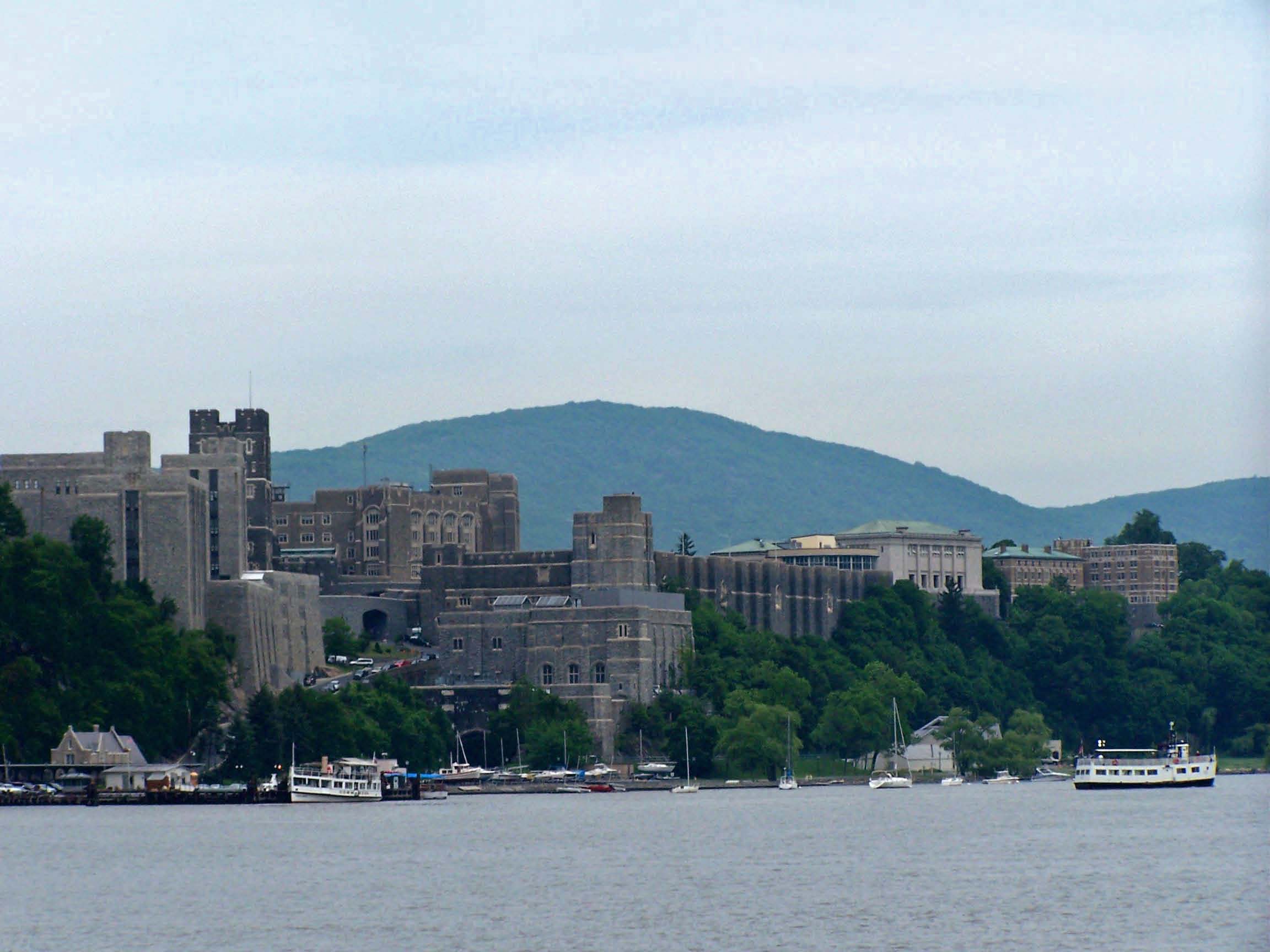
| West Point |
We left at 8:15, figuring the tide would help us at the start and slow us at the end of our day, and that's
just how it worked out.
The current started turning on us when we passed West Point at about noon. Since 9/11, recreational
boats have not been allowed to tie up at West Point to tour, so we had to be satisfied with passing by slowly and making liberal
use of our binoculars. The campus is built on a steeply sloped hillside. Its central area resembles nothing so
much as a mighty fortress, but other areas of the sprawling campus are less austere. After seeing the Air Force Academy
in October, Marine Boot Camp graduation and the Naval Academy in May, we were sorry we couldn't do more than
cruise by at a restricted distance, especially since son-in-law Rod is a West point grad.
|
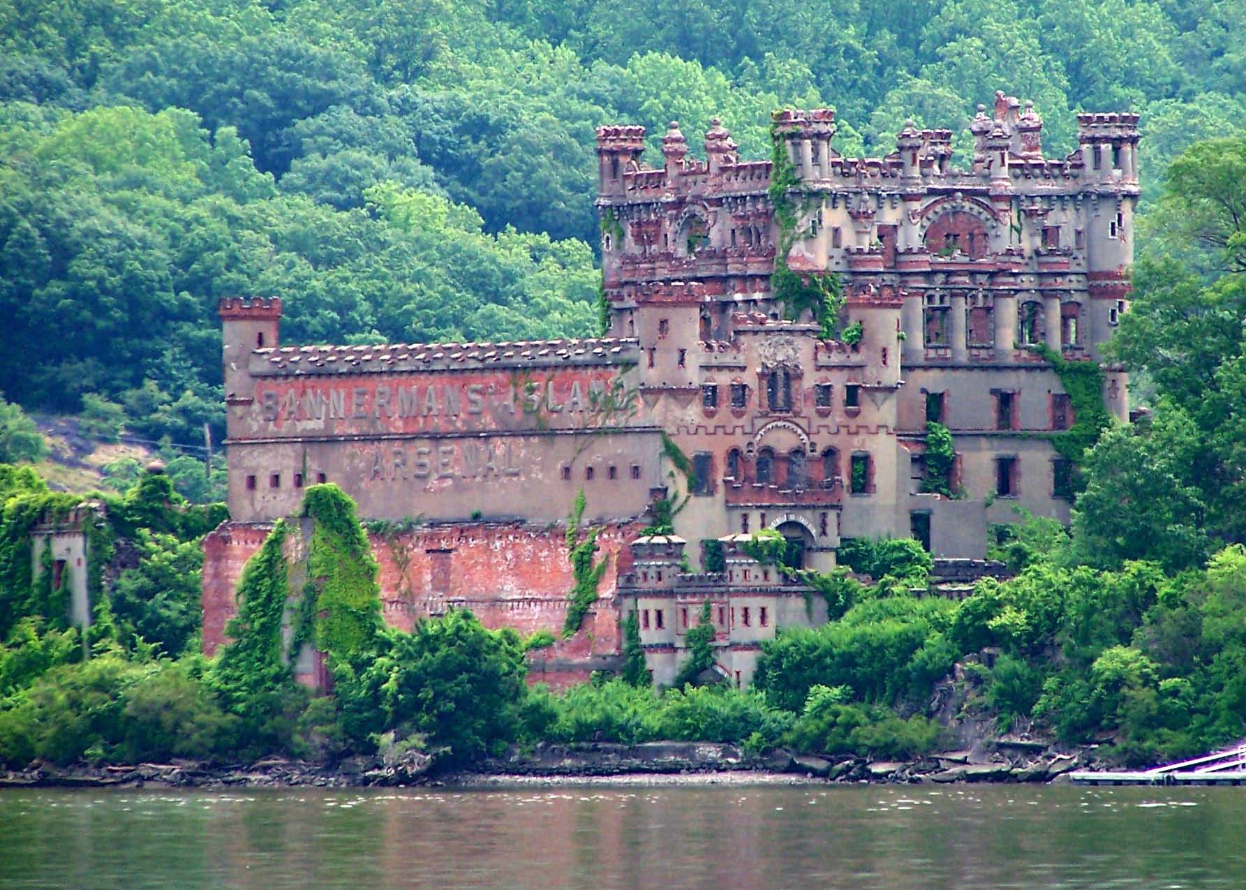
| Bannerman's Island Arsenal |
Just around the bend from West Point, we came upon an island with the shell of an ornate stone and
brick castle seven stories high that looked like it was designed by Dr. Seuss. It had every kind of fanciful fortress
architectural detail imaginable with no right angles visible. An elegant old world estate perched high above the
river in the islands's center, slowly crumbling away from neglect.
Frank Bannerman bought the island, officially known then and now as Pollepel Island, in 1900. He designed
the castle himself, in the style of old Scottish castles from the land of his ancestors, and called it Bannerman's Island
Arsenal. He used it to store the vast inventory of military surplus goods he didn't have room for in his one block
long warehouse and show room on Broadway in New York City.
He was a pioneer of the used arms business, and his holdings were immense. He bought 90% of
all the captured arms from the Spanish American War, and researchers have estimated that 50% of all commemorative cannons
placed in public areas in the early 1900s were purchased from Bannerman. The ruins are the result of a suspicious fire
in 1969 whose light could reportedly be seen 25 miles away.
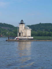
We also passed three beautiful lighthouses along the river. Whereas most of the lights we have seen
on this trip have been designed as light towers with a secondary function as living quarters, the Hudson River lights are
houses first, with towers incorporated in their design. Below is a photo of the Rondout Lighthouse, which marks the
entrance to Rondout Creek, where we anchored. To see more lighthouses from our past three days' travels, click the picture,
and it will take you to the photo album page. (This is the same page you see if you click the link at the top of New York
State page 1.)
|
| Rondout Light -- click the pic for more lighthouses |
We anchored overnight at a protected little anchorage about four miles up Rondout Creek, past Kingston.
Although we passed a big scrap yard, lots of rusty barges (some half sunken), ruins of a bunch of past industrial enterprises
and some current ones on their way to ruin with rusty roofs and broken windows, when we finally got to the anchorage, it was
in a pretty spot near a marina, with a view of a waterfall and an island.
June 4, 2005 Kingston to Waterford
68.5 miles
Suddenly Summer
We started at 8:30, 2 1/2 hours after low tide, and caught the tide just right to get a boost all the way
to Waterford, "Gateway to the New York State Canal System."
After months of following a cool spring up the coast, hearing reports at each place we stopped
that the temperatures were below normal, rainfall was above normal, and winds had a northerly component in them, today
was the first day we hit summer.
The sky was blue, it was warm enough to start the day in shorts, the temperature rose to a bit over 80 degrees
and a pleasant breeze blew. We had a perfect cruising day.
The boating gods can't stand perfection.
Just after 1:30, when we had been cruising blissfully for over five hours, we felt a huge vibration from
our engines. Dick quickly pulled them back to idle speed, then built up our speed again, and we were fine, for a short
while. Based on the symptoms, Dick quickly diagnosed the problem as a clogged fuel filter, and figured out that we could
keep going, if we babied it and went slow. he was planning to change the oil and the fuel filters in Waterford anyway.
On further reflection, we hypothesized that all the rocking and rolling we did in Delaware Bay and the ocean
stirred up the old fuel from the bottom of our tank, which has who knows what kinds of algae and crud in it. As a result,
the filters filled more quickly than they did last time we changed them after more sedate boating.
It was Lady's Day on the Hudson. For most of the day, we traveled in tandem with Loopers Frank and Joyce
on Barefoot Lady. Then, as we neared the lock before Waterford, a Looper on Nauti Lady who saw
our burgee from his berth at a marina radioed us with tips about great stops we should make as we headed north. When
we got to Waterford, we were delighted to see Gayle and Gay on Classy Lady at the dock. We met them at the
Beaufort Rondezvous, and had only seen them again briefly in Cape May. Thanks to a glitch in the arrival of a package,
they would be here a while.
We were all tied up and connected to power at the Waterford Free Dock at a little after 4 pm. Ron,
an enthusiastic dock volunteer, gave us the lowdown on the town, suggestions for things to see and do, and offered
to help Dick get whatever he needed to complete his boat projects. We haven't had service this friendly and attentive
at most of the marinas we paid to stay at. Come to think of it, this reminds us of how warmly we were treated by the
Rose Buddies back at the Elizabethtown Free Dock.
Just as we were beginning to think about dinner, in drove Salty Dog, after a 110 mile day.
The crews of Salty Dog, Classy Lady, Barefoot Lady, and Starsong headed for Don and Paul's Cafe,
where we had read on the Great Loop website that a good meal could be purchased at a remarkable price. Most of
us opted for the special -- a fish fry for $5. It was a good meal at a remarkable price, indeed.
As we were leaving dinner, Dick and I were fantasizing about coming back to Don and Paul's for breakfast
tomorrow with the Sunday New York Times. Out in front of the restaurant, four middle-aged to almost retirement-aged men were
sitting on chairs on the sidewalk watching the traffic go by. One of them, amazingly enough, had a New York Times
tee shirt on (and an apron -- we thought he might have been taking a break from the restaurant kitchen). We asked where
in town we might get a copy of the New York Times, and stumped them all. Possibly it could be found in Troy, one
thought. Maybe we would have to go all the way to Albany. The guy with the NYT tee shirt tried to call someone who might
have a line on the Times, but to no avail. He did volunteer that he got Investor's Daily, though. We were nonplussed.
|
|
|
|
|
|
|
|
|
|
|
Some New York State Official Symbols:
The state bird is the Eastern Bluebird.
The state flower is the rose.
The state beverage is milk.
The state fruit is the apple.
The state tree is the sugar maple.
The state song is I Love New York. Has anyone ever heard anything except the chorus
to this song? (The chorus is the title of the song repeated three times.) I can't remember hearing any lyrics.
After reading the lyrics, I couldn't place a tune to them. I couldn't even place a state to them. They are so
generic as to apply to anywhere. Try it -- substitute any state name for New York, and see if it works:
There isn't another like it.
No matter where you go.
And nobody can compare it.
It's win and place and show.
New York is special.
New York is diff'rent cause there's no place else
on earth quite like New York and that's why
CHORUS: I LOVE NEW YORK (3X)
|
|
|
|
