|
|
 |
|
|
|
Tuesday, May 3, 2005
Elizabeth City to The Great Dismal Swamp
24.4 miles
About the Name
Clearly, this place was not named by the local Chamber of Commerce. Colonel William Byrd II surveyed
this region in 1728 as part of his work in establishing the dividing line between Virginia and North Carolina. He described
the swamp as a "vast body of dirt and nastiness, " and is the person credited with adding the word "Dismal" to the area
previously noted on maps as a Great Swamp.
|
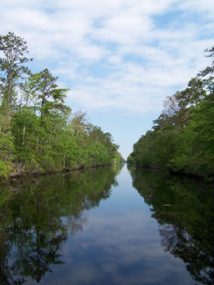
| A Dismal Vista |
About the Canal
The Dismal Swamp Canal is the oldest continuously operating canal in the country. It is 22 miles long
and connects the Elizabeth River in Virginia to the Pasquotank in North Carolina.
Slaves began the back-breaking work of digging the canal by hand in 1793, and flat bottomed boats began
plying its waters in 1805. By the 1820s canal traffic was a vital commercial link between Virginia and North Carolina,
and the canal was improved to accommodate boats with deeper drafts. The swamps around the canal held havens for runaway
slaves who had become familiar with the area while working on the canal.
By the 1920s commercial traffic subsided, and the canal fell into disrepair. In 1929 the Federal government
bought it for $500,000, and the Army Corps of Engineers took over responsibility for its maintenance.
This year, even though the Canal is on the National Register of Historic Places and is a National Civil
Engineering Landmark, the Federal Government appropriated no funds for it. After protests and some political haggling,
there was a supplemental appropriation to keep it open until September. We are doing the canal route now, because next
year may be too late.
About Our Passage:
The swamp was not what we expected. It was not at all dismal, and hardly swampy, either. The
canal's Coca-Cola-colored waters slice through heavily forested shores interspersed with farm fields. A busy highway,
Route 17, runs right beside a long section of it, so we found ourselves cruising at a tranquil 6 mph, while cars and
loud trucks zoomed by us at over 60 mph.
To enter the canal, boats pass through a lock that only opens four times a day, at 8:30, 11, 1:30 and 3:30.
We locked through with 12 boats, then proceeded through the canal in a single file caravan. Chances of seeing wildlife
are reduced when they have been flushed by the boats at the front of the line.
We docked at the Dismal Swamp Welcome Center. We had been visualizing the Welcome Center as a place with
exhibits, and rangers or naturalists on staff offering maps of routes through the surrounding swamp that we could paddle in
our kayaks. Maybe even some hiking trails with good birding.
Instead we found ourselves at a highway rest stop for Route 17, with a free face dock serving Dismal Swamp
cruisers. It is the only state-sponsored welcome center in the country that serves both boats and road vehicles.
As for the kayak trail, it is the canal. No little offshoots into the swamp, because there isn't much swamp around the
canal now. There was a 1/4 mile nature trail, but that took about 15 minutes to cover thoroughly.
As we were cruising, we had noticed what looked like a bike trail next to the canal, and we asked about
it at the Welcome Center. The staff wasn't sure it was safe to travel yet -- it is a work in process. We
decided to give it a test run. We rode back to the town of South Mills, where we had locked through into the canal at
11:30. We were hoping for small town charm and maybe a Dairy Queen, but were sad to find that the town consists
of two gas stations, four churches, a flea market store selling items that look as if they were chosen from the curb
on trash day, and less than ten streets of modest homes, many of the pre-fab variety.
|
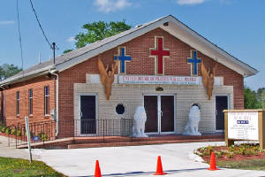
| Church with lions and angels |
We did discover one architecturally unique building on our ride. We have taken many historic
walking tours and learned a lot about architectural styles, but this church stumped us. It defies categorization.
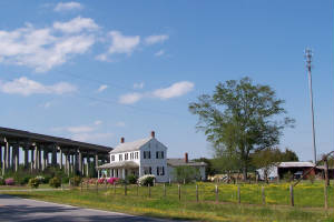
We also saw a simple old farm house with a highway towering over it and a cell tower in the field behind
it that encapsulated the demise of the charming historic places we have mourned along the way.
Thinking back on the North Carolina motto (To be, rather than to seem), today nothing seemed to be
as we expected it to be. But, we learned a lot by having our expectations unmet.
Wednesday, May 4, 2005
Dismal Swamp Visitor Center to Portsmouth, Virginia
27.9 miles
We woke up at 6 a.m. to an outside temperature of 42 degrees, and inside temperature of 52. Because
the dock did not have electricity, we didn't have our heat on all night. We needed to run our generator to run the heater,
but another boat was rafted to us on the dock, and we hesitated to turn on our generator so early in the morning for
fear of waking our neighbors with the noise.
Imagine our relief as we heard the footsteps of one of our neighbors on Apolonia walking across
the deck over our heads at 6:15. We took that as our all clear signal, and proceeded to rev up.
Timing isn't everything, but in the single file world of the Canal, it is a big thing. We coordinated
our departure with the other boats on the dock so that we would all make the lock opening at the end of the canal on schedule,
but we would not be traveling in a parade.
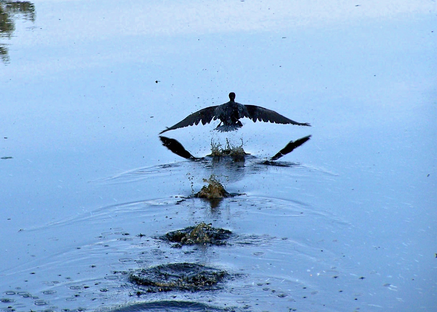
Consequently, we had some more interesting views of wildlife today. We were following a
cormorant up the canal for nearly an hour. He would fly a few hundred yards ahead of us, then float and wait
for us to catch up before flying a few hundred more yards. Cormorants have an amusing take-off pattern of dipping their
feet in the water three or four times before they get enough height for their feet to clear.
We watched a deer swim across the canal just ahead of us, and saw his return trip about ten minutes later
further along the canal, still just ahead of us. We were surprised at how swiftly he swam, with just his head visible.
We had to hold up to keep from running over a ground hog. We saw him flailing along just off our bow,
and quickly decided he couldn't be an otter or a beaver, based on beginner level swimming skills. We held position so
he could pass in front of us, and we stayed put until we could see him climb out on the bank. Once he dragged himself
out of the water, it was clear that he was one very waterlogged groundhog.
|
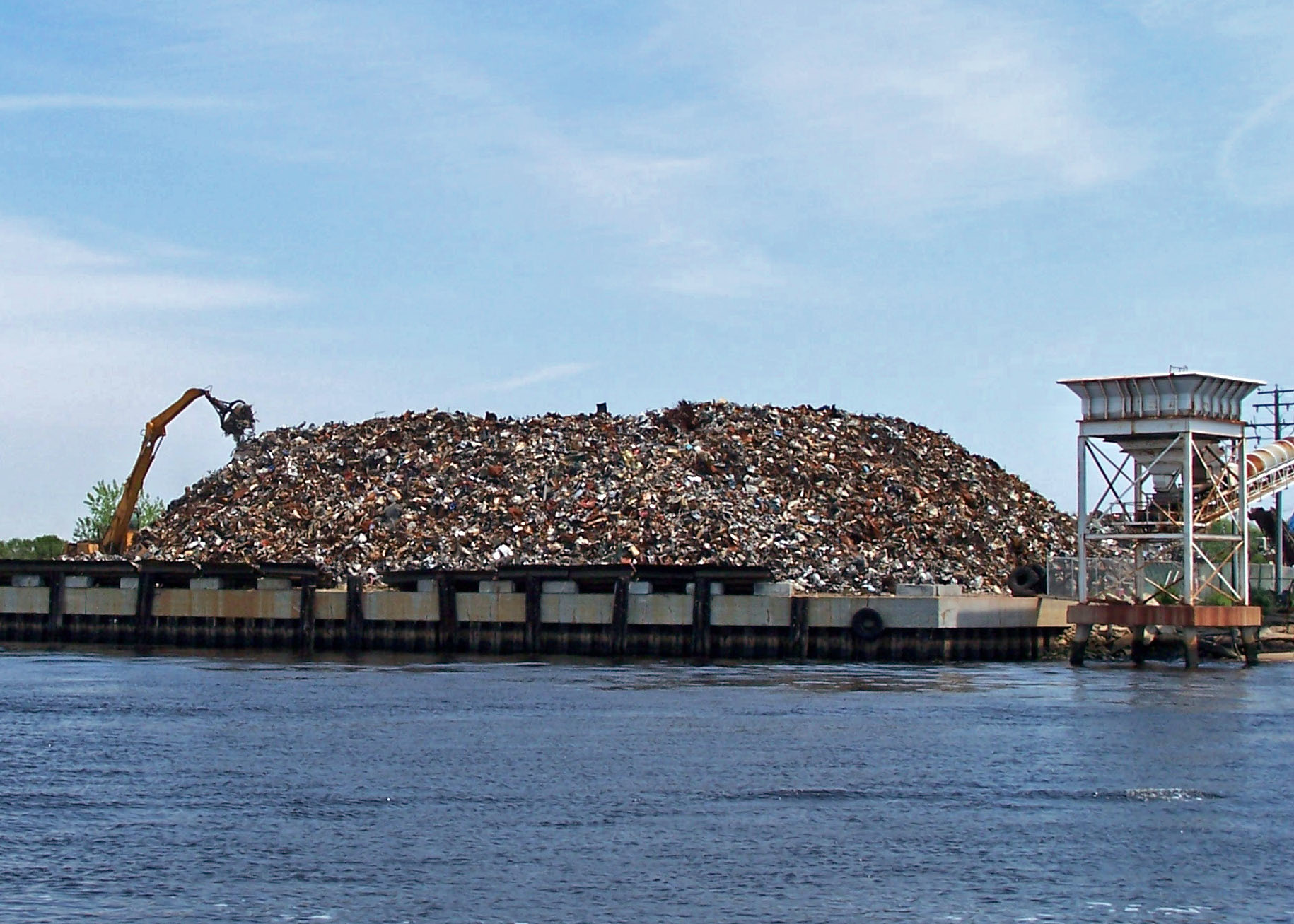
| Recycling on a large scale |
When the Deep Creek Lock gates opened, we passed out of the canal and into instant civilization.
Scarcely more than half an hour from the lock, we were on the Elizabeth River passing this huge scrap yard with
a pile of crumbled metal five stories high. A crane with a grabbber on a cable was picking up big scoops of metal and tossing
them about.
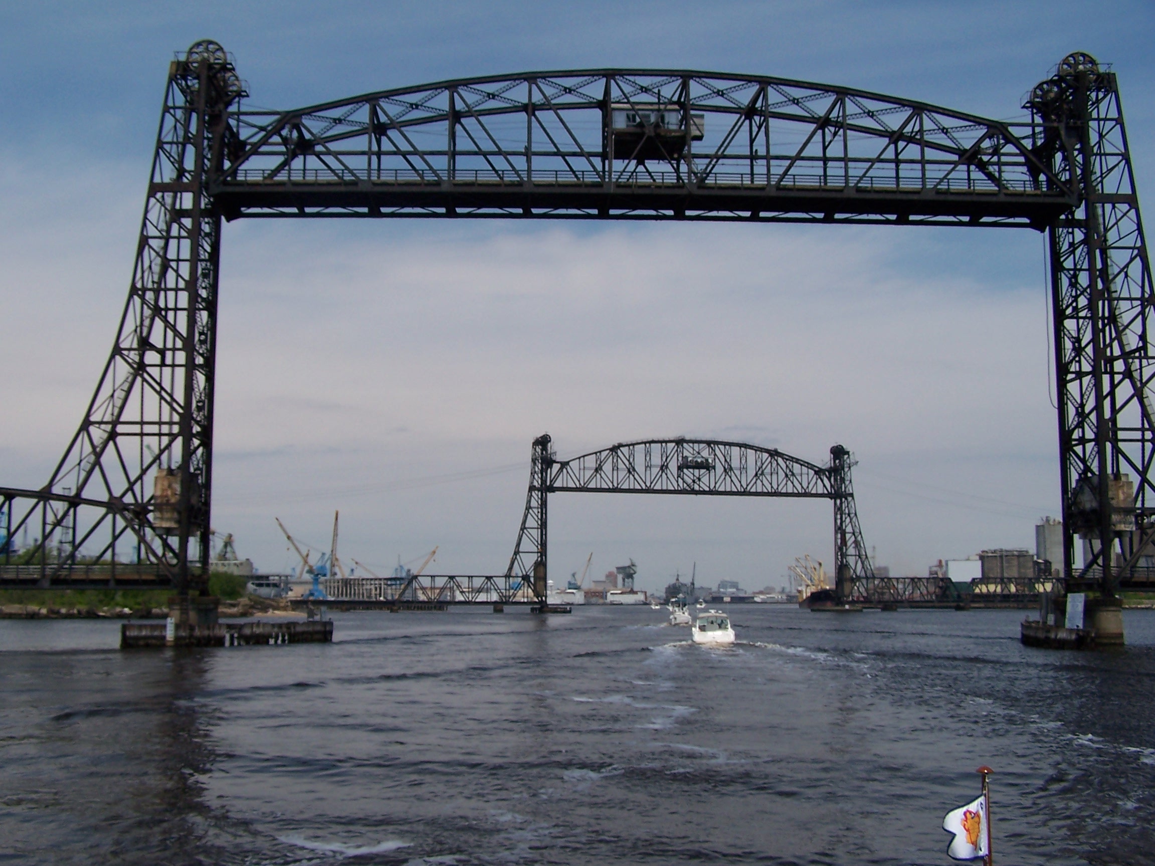
We passed the Naval Shipyards, cordoned off and heavily patrolled by police boats, a couple massive floating
dry docks with ships inside, and lots of tugs and barges criss-crossing the River.
This double lift bridge on a huge scale marks the entrance to the largest natural harbor in the world, home
of the largest naval base in the world. We will stop here before beginning the next part of our journey in the Chesapeake
Bay.
When the bridge opened, and our tiny boat passed beneath its towering spans, it seemed symbolic of our place
in the world of giant cruise ships, aircraft carriers, warships, and commercial vessels that ply these waters.
|
|
|
|
|
|
|
|
|
|
|
|
|
|
|
