|
|
 |
|
|
|
|
|
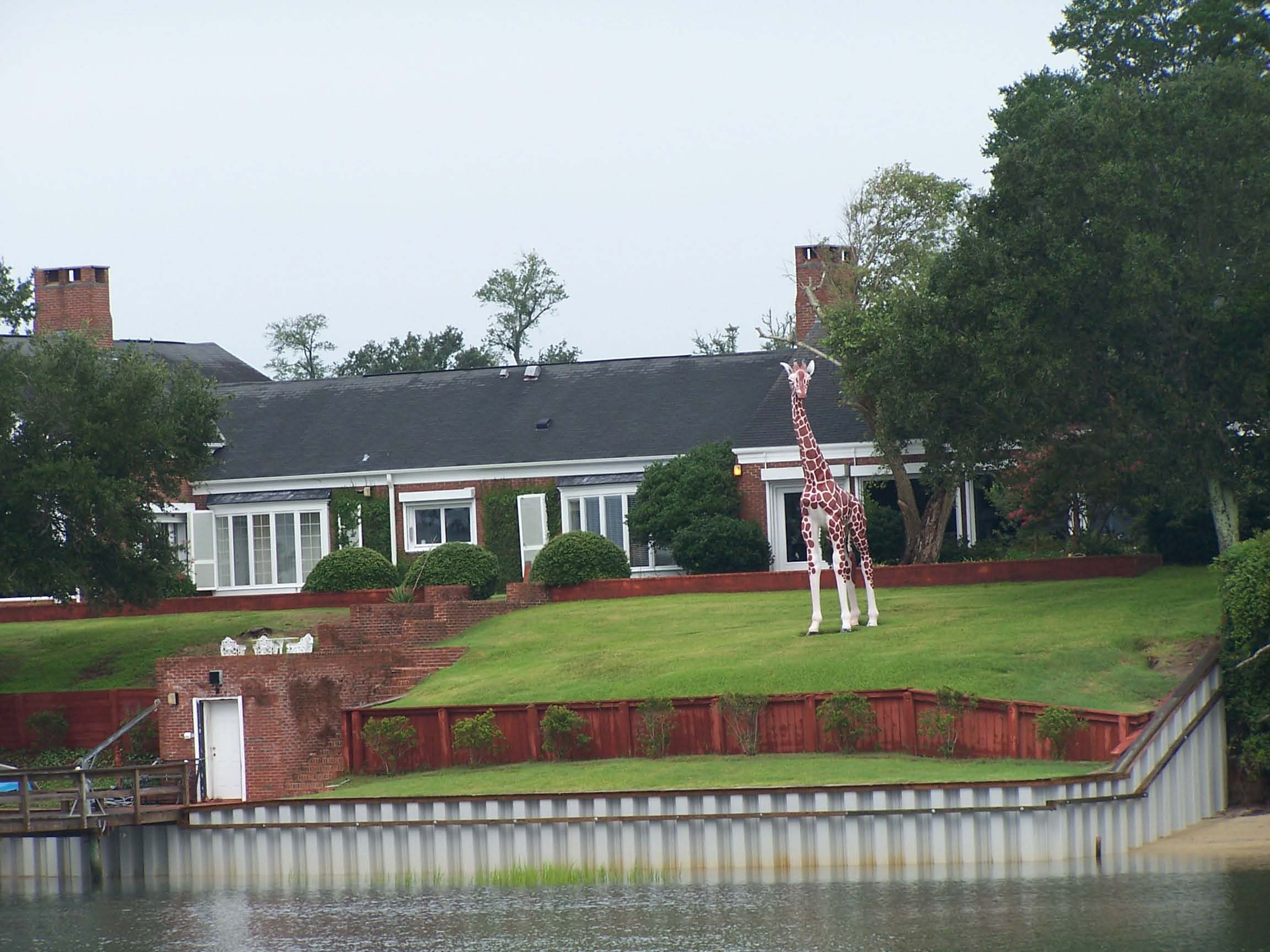
| A giraffe sighting along the waterway |
Sunday, August 12, 2007
Southport, NC to North Myrtle Beach, SC
44.5 miles, 2038 trip miles
We began our day with a big traditional breakfast at a restaurant behind our marina that looks like a run-down gas station/quick-mart
on the outside, and like a jazzy primary school all-purpose room/cafeteria inside. What it lacks in atmosphere
it more than makes up for in food and service. We were there when the doors opened at 7 am, had our coffee by 7:03, were
served our perfectly prepared eggs within less than ten minutes, and were out of there within a little over half an hour
(it could have been less, but we were reading the local Sunday paper while eating).
We were off the dock by 8 am, as the captain ordered. We had to time our departure to hit the Sunset Beach
Pontoon Bridge in time for its noon opening. The bridge only opens on the hour, and it doesn't open at all for a couple
hours around low tide, so getting there at the right time is critical. Especially on a hot weekend day, like today,
when people on jet skis are buzzing around like pesky mosquitos and fast boats are passing with nary a thought about
the effects of their wakes. Sitting waiting for the bridge in these conditions is worse than being caught in a summer
traffic jam in a car with broken air conditioning. At least in the car you are sitting still or going slowly on a known
trajectory and are surrounded by other people sitting still or moving slowly. On the water, we have to try to maintain
position in current and wind that push us around, while other boats around us circle and pass, create wakes and jump wakes
unpredictably.
|
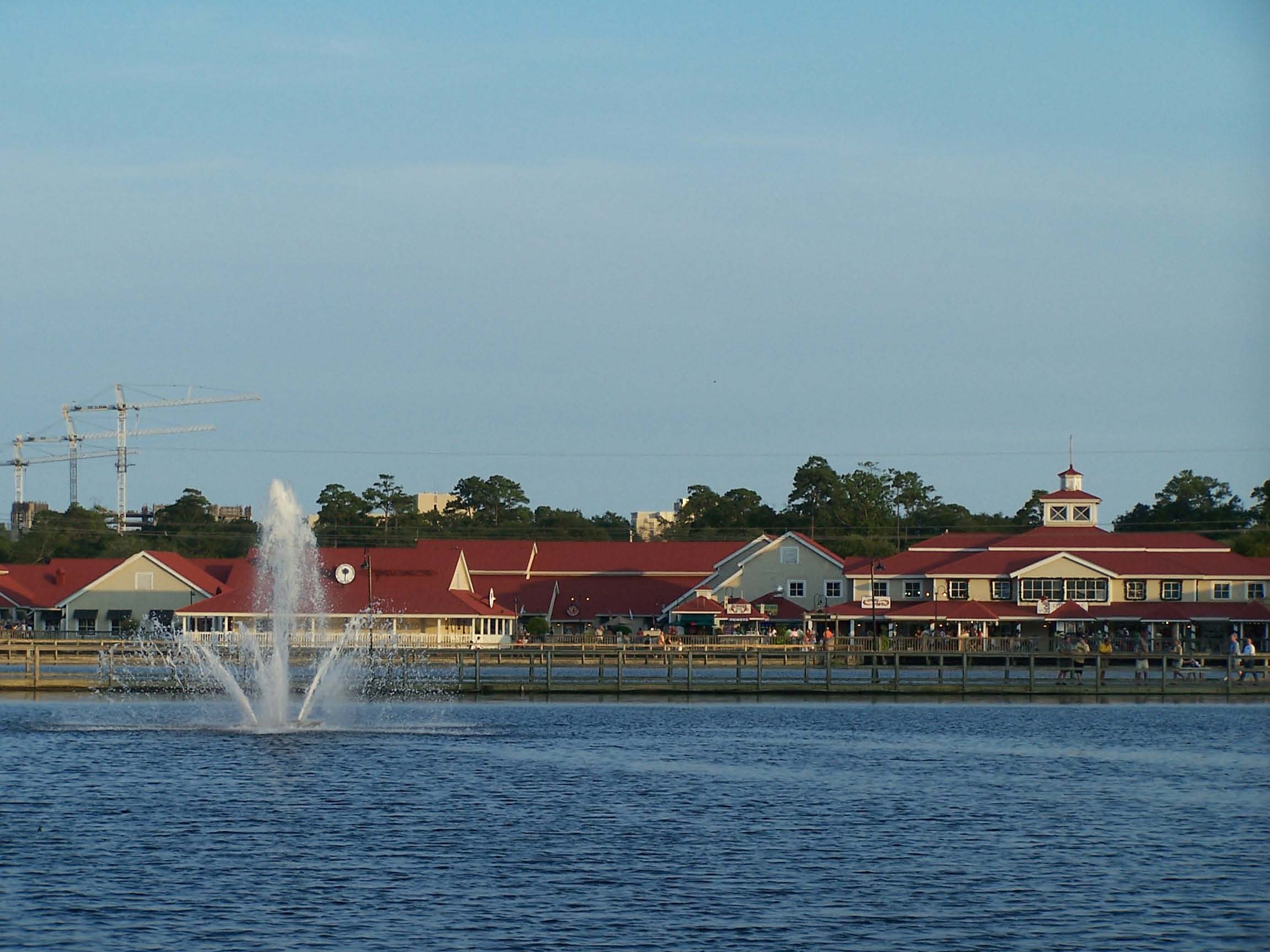
| Barefooot Landing |
Dick's planning was, as usual, flawless, and we passed through the pontoon bridge with 16 other boats at the noon
opening. After the bridge, we entered the Little River, which, as its name implies, is narrow. We felt like we
were on a boat super highway. It was a bouncy ride with all the propellers frothing up the water.
We were glad when we finally arrived at Barefoot Landing at a little after 2 pm. The last time we stayed here,
when we were looping in 2005, Barefoot Landing was a free dock, subsidized by the management of the adjacent outlet mall and
restaurant complex. Boats were rafted to each other, triple parked at the dock. Now, the place is under new management,
and they charge to stay on the dock, which has cut back dramatically on the number of boats docked there. There
was plenty of room for us. We are sure the people running the stores and restaurants don't even miss the business from
those extra boats -- the place was mobbed with sun-burned families, especially in the evening.
We ate dinner at an island-themed restaurant, and enjoyed our daily ice cream cones while sitting in rockers near an
outdoor mechanical bull ride. The operator of the ride controlled the actions of the bull with a couple of joy
sticks, and he controlled the crowd around the ride with a masterful patter. He could read family dynamics better than
Dr. Phil. He would ask siblings of a bull rider if they wanted him to make the bull go faster, then he would warn the
rider, "Your sister told me to make it go faster," just before he spun the bull to dump the rider. He took special
glee in prompting kids to gang up on a riding parent -- "Do you want me to make it go faster for your daddy?" -- then giving
daddy the ride of his life. He gave timid younger siblings a soft ride, with just enough challenge to it that
they could feel like they rode the bull as well as a big kid. When we finally got up from our rockers, we felt as though
we had watched a great show, and a great showman.
I took Dick's wallet to go clothes shopping, and sent him back to the boat. I didn't shop long -- pooped from a
long hot day, I brought my purchases back to the boat, promptly went to bed, and was asleep before the mall stores closed
at 11.
Monday, August 13, 2007
Barefoot Landing to Georgetown, SC
51.7 miles
As we left Barefoot Landing, a tag team relay of kingfishers flying, briefly lighting on a waterside branch, then
flying again, led us south through the Pine Island Cut, a narrow 28 mile canal lined with beach houses, condos and golf
courses. The Waterway Hills Golf Club straddles the cut, and has an aerial tramway with gondolas that carry the golfers
and their clubs over the water from one hole to another.
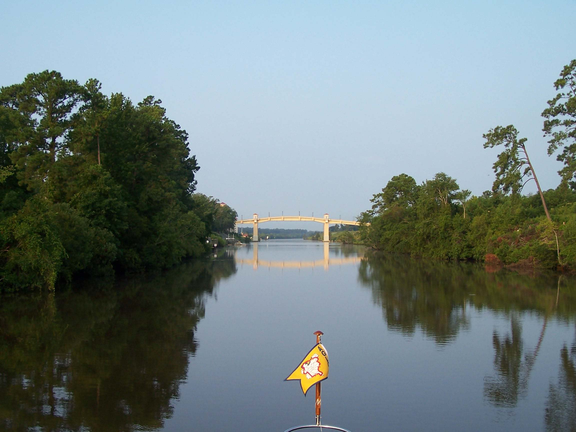
The Pine Island Cut is the most recently completed section of the ICW, opened in 1936. Most of the cut was dynamited
through limestone, and as the job of cutting through got more difficult, the Army Corps narrowed their specs for the channel
width. The canal is unaffectionately known as "The Rock Pile," and everyone that travels it knows a story about
a boat driven against the rocks by the errant wake of a passing boat, or someone dinging a rock when accidentally straying
from the channel. We emerged unscathed.
|
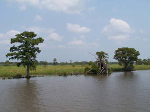
| Old rice field |
After the rockpile, we left the heavily built residential area behind, and traveled through one of our favorite sections
of the waterway, the winding Waccamaw River, with miles and miles of lush cypress swamps along its shores, and hardly a sign
of civilization in sight.
As we neared Georgetown, the remains of thousands of acres of rice fields dating back to the 1800s stretched for miles
along the shore. Before the Civil War, over half of all the rice grown in this country came from South Carolina. The
rice was known as Carolina Gold, because of its color as well as its financial effects
We learned all about the rich history of Georgetown and the surrounding rice plantations on our first visit to Georgetown.
If you would like to learn more, you can click the link below that will take you to our journal page from our first visit.
(If you scroll down a ways, the page also has a picture of the golf course sky tram.)
Click here to see pictures of Georgetown, and learn more about its rice culture.
On this visit, we hunkered down in our air conditioned boat, and didn't do much in town. We visited the
bakery and the bookstore, ate dinner at our favorite restaurant, and checked out the boats docked along the waterfront
boardwalk.
The closer we get to home, the more our thoughts are centered there, and the less enthusiasm we have for exploration
along the way.
Tuesday, August 14, 2007 Georgetown to Charleston
64.3 miles
Within an hour of leaving Georgetown, we passed North Island, the place where French Generals Lafayette and DeKalb
secretly met with Patriot leaders to offer them France's assistance during the Revolutionary War.
A couple hours later, we enterd the Cape Romain National Wildlife Refuge, which covers 64,000 acres, is home to over
250 species of birds, and offers beautiful wild marsh and woodland vistas along over 20 miles of the ICW.
As we passed through the Refuge, we saw about a dozen alligators swimming in our path, the first alligators we have seen
since we headed south. We figured they found plenty of food in the refuge, judging from all the birds we saw gathering
on the oysterbeds and feeding on the mudflats near the prowling gators.
Several groups of dolphins came to greet us and swim in our side wake today. One group even stayed with us for a record
time of fifteen minutes. Our southern dolphins seem friendlier and more eager to swim and play around our boat than
the dolphins up north. We aren't sure if they are different species of dolphins, or if there are regional behavioral
differences -- a dolphin version of Southern hospitality. No matter what the reason, we are glad to be back among dolphins
that consider us playmates.
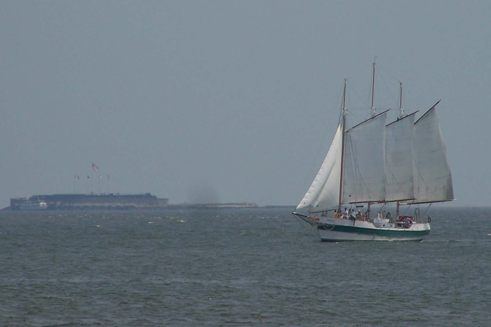
|
| Charleston Harbor (Ft. Sumter in background) |
We passed Fort Sumter in the middle of Charleston Harbor a little after 2 pm. Someday, we will park our boat
at its dock and tour this famous fort where the Civil War began. But, with a heat index of 105, today was not the day.
We did learn a new fact about Fort Sumter from our cruising guide -- no one was killed during the 34-hour battle for
the fort. But, after the Union surrendered, when they were performing a ceremonial 100-gun salute to leave the
fort with dignity, two of their soldiers were killed when a shot misfired. This was just the first two of many
deaths due to misfire and mistake during this war, as we have learned during many visits to forts, battlegrounds and memorials on
our travels this summer.
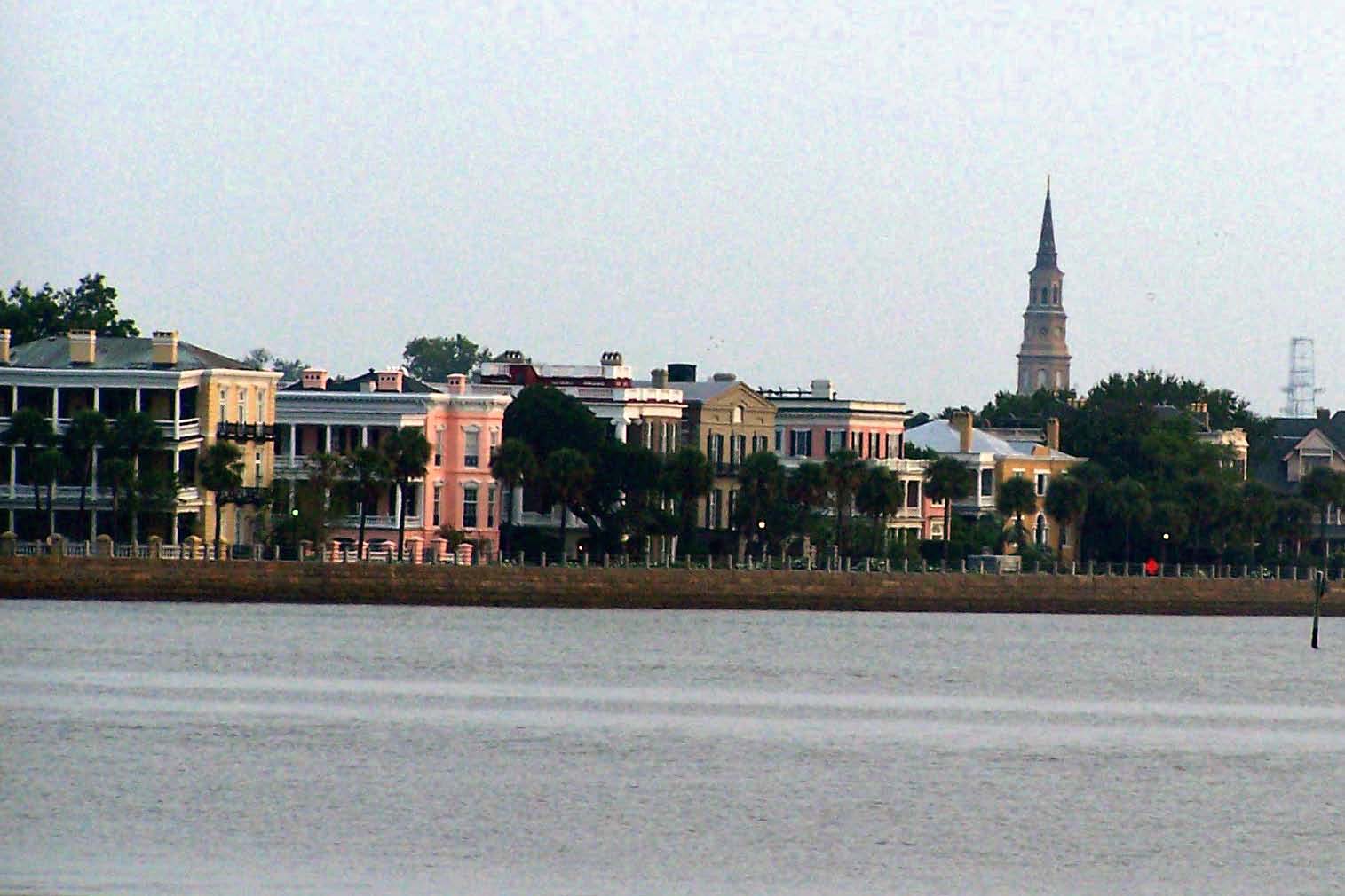
Charleston is the Grand Dame of Southern cities -- with antebellum homes gracing narrow cobblestone streets and church
spires piercing the skyline with nary a sky scraper in sight. There are museums, markets, and art galleries to explore;
and historic walking tours and carriage rides all around the town. Modern attractions include an aquarium and and IMAX
theatre. Pretty gardens lie behind brick walls and ornate wrought iron fences. Parks with historic plaques and
commemorative statues offer welcome shade and benches for a warm and weary walker.
With all these choices, what did we do?
We donned our bathing suits, packed up our books, and headed for the pool at the Charleston Harbor Resort and Marina.
We dipped ourselves into the huge lapis-blue tiled pool, then plopped down on the comfy cushion-covered teak chaises pool-side.
With all the palm trees, bouganvillea, and big pots of tropical flowers around us, and views of water and white sand in the
spaces between the lush landscaping, we were in a generic tropical resort paradise. We could almost imagine we were
in Mexico, or Jamaica, or the Bahamas . . . until a massive cargo ship on its way to Port Charleston loomed in the shipping
channel just a few hundred yards from the pool.
Our resort offered free water taxi and land shuttle service to the downtown restaurants, and had its own restaurant onsite.
So, where did we eat?
We ate aboard. Not only did it require the least effort to overcome our in-port inertia, we also would have a hard
time finding a restaurant that could prepare a meal more tasty than the one bubbling in our crock pot. We had been drooling
from the aroma of it every time we came down from the flybridge since noon. Roxanne shared the recipe with me, and I'll
share it with you -- it is in the box at the bottom of this page.
Before you look at the recipe, though, I want you to read this disclaimer:
Although you wouldn't guess it from the recipes on this website, when I cook I often use fresh ingredients
and recipes that involve more preparation than opening cans and bottles. I even own a Martha Stewart Cookbook (and have
used it a couple times). Therefore, the following recipe should not be considered representative of my cooking abilities
or proclivities (although it might be representative of my quest for quirky and tasty).
|
| Charleston |
August 15 Charleston Harbor to Lady's Island (across the river from Beaufort, SC)
70.8 miles
Before we leave beautiful Charleston, I should point out, to anyone missing the historic perspective we usually
include here, that we have a very thorough description of our last stop at Patriot Point in Charleston located in our Archives.
Our description includes Fort Sumter history, observations from our tours of several naval vessels at the Patriot Point
Maritime Museum, and a bike ride to Mount Pleasant and the Shem Creek fishing village. To view it, just click on the
Archives: Where Have We Been? heading in the left margin of this page, then scroll down on the first
Archives page to South Carolina, North of Beaufort April 16-21 (you will see that Charleston
Harbor is listed there), and click the link.
We are traveling familiar cruising grounds today. We are back in the low country, where the rich organic mud at
low tide smells of salt and sulphur and oysters that lived here for hundreds of years. Fields of yellow-green marsh grass
stretch for acres and acres as far as we can see at low tide, then all but disappear with the rising tide.
Ancient oaks drip Spanish moss (which is not Spanish, nor is it moss). And, it feels like home.
We planned to stop at the Beaufort Downtown Marina, which is in the middle of the quaint and historic town of Beaufort,
but the marina was full of boats gathered for a big fishing tournament. So, we stayed on Lady's Island, across the river.
We could have walked to Beaufort in about 25 minutes, up the road and across a swing bridge crossing the Beaufort River.
At the other end of Lady's Island there is a tall highway bridge to across Port Royal Sound that was in the news earlier this
summer when a barge being pushed by an unlicensed pilot hit the bridge with a carelessly extended crane, causing damage that
required traffic to be shut down to just a lane or two during repairs, causing a huge commuter mess. But, at least Lady's
Island has two bridges to the mainland.
There are lots of people around here living on islands connected to the mainland by just one bridge -- us included.
When a damaged bridge is in the news anywhere, as it was when the Lady's Island bridge was hit, and more recently with the
catastrophic collapse of the bridge in Minneapolis-St. Paul, people living on the islands can't help but think about
what would happen if their bridge became inoperable.
As we are in hurricane season, this concern looms even larger.
Which reminds us that the last time we stayed at the Lady's Island Marina, we were racing south to Hilton Head Island,
trying to get to our car there before a hurricane on its way up the coast beat us to it. The torrential rains and some
big wind squalls that preceded the hurricane were just arriving at Lady's Island as we arrived there, and the dock hand was
not terribly encouraging about whether the marina owner would let us stay tied to the dock if the hurricane got there before
we could leave (his docks would survive better without boats tethered to them, and he was more concerned about his docks than us
or our boat).
They didn't kick us off the dock, we used our radar for the first time when we had to navigate blind through a couple squalls
the next day (sure wish we had tried it out in good weather first, just to see how it worked), and we made it back to our
car in Hilton Head just as they declared a voluntary evacuation of the island.
This time, we had no such excitement, but we did visit the Dairy Queen where on our last visit we sat out a torrential
rainstorm, eating hot fudge sundaes surrounded by our waterlogged groceries, waiting for a break in the rain to make
a dash back to the boat. We had hot fudge sundaes this time, too, but no break in the sauna-like heat as we walked
back to the marina.
Thursday, August 16 Lady's Island to Skidaway Island
67.0 miles today, 2,293 miles for the trip
HOME AGAIN
We can only safely make it through the entry channel to our home marina at mid-tide or higher. Dick checked
the tide tables and delivered the bad news last night -- we needed to get off the dock by 6:15 in order to arrive home in
time to get in.
We set the alarm for 5:30. While we were preparing to depart, it was dark, the water was flat, there
was no wind, and we could hear a dolphin nearby, rising with a blast of breath, swimming for half a minute or so,
then rising to breathe again.
We were off the dock in the dark at 6:10. Fortunately, we know the water pretty well, our chart plotter was
working fine, and there weren't any crab traps around. Sunrise was at 6:46.
|
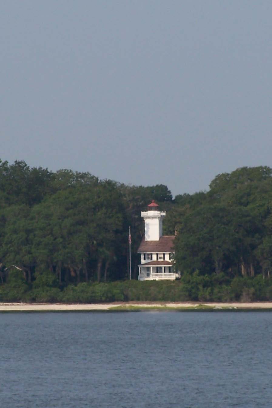
| Haig Point Light |
We wove our way through the serpentine rivers and creeks that the ICW follows through our low country marshes and islands.
At mid-morning we passed the Haig Point Light on Dafauskie Island. This pretty little two-story Victorian house
with a light tower rising above its steeply pitched roof was constucted on the foundation of a plantation mansion destroyed
during the Civil War. It was first lit in 1873, and at that time was the back light of a two light range intended to
help ships find the entrance to Calibogue Sound. Because the entrance was subject to frequent shoaling, the front light
was mounted on rails, and could be moved as the shoals moved. Ships would line up the front light with the light in
the lighthouse tower, and keep them aligned in their sight as they entered the Sound.
The lighthouse was decommisssioned and sold in 1925, and the new owner used it as a hunting lodge until one tragic evening
when one of his tipsy guests fell from the tower and lost his life. That fatal fall pretty much pooped the party atmosphere
of the place for years. The light fell into disrepair and was vandalized, as seems to be the pattern for decommissioned
lights that no one watches and protects with vigilance.
In the 1960s the plantation property and the light were sold to a man who put a lot of sweat equity into his labor of
love light renovation. Then International Paper Realty Company bought the property, completed renovations on the light,
and re-lit it in 1986 during a grand party that included fireworks and a concert by the Savannah Symphony, who played
The Stars and Stripes Forever during the lighting.
Now the lighthouse is the guest house for the upscale Haig Point golf course community on the island, and it is
the icon on the community logo. If you pay $350 for a "Discovery Weekend" at Haig Point, you can stay there.
I should point out that there still is no bridge to Dafauskie Island. Residents and visitors take a private ferry
that runs every hour on the half hour to get to and from the island. The ride takes 25 minutes.
At 11:30 we passed Thunderbolt, where we have our bike club and our sailing club meetings at Tubby's Tank House, and
where we take Starsong for her maintenance and repair work. At noon, we passed Modena and the Marine Institute
on the northern tip of Skidaway Island. We passed beneath the Skidaway Narrows Bridge, which is a worry and a frustration
to many of our neighbors, who would feel much safer if we had a very tall wide fixed bridge, rather than our little two-lane
drawbridge connecting us to the mainland.
Then, at 1:30, we turned into Delegal Creek, the entry channel to our marina. Fighting both wind and current,
with the help of dockmaster Jimmy and dockhand Gerard, Dick got us tucked in our slip, and we were home.
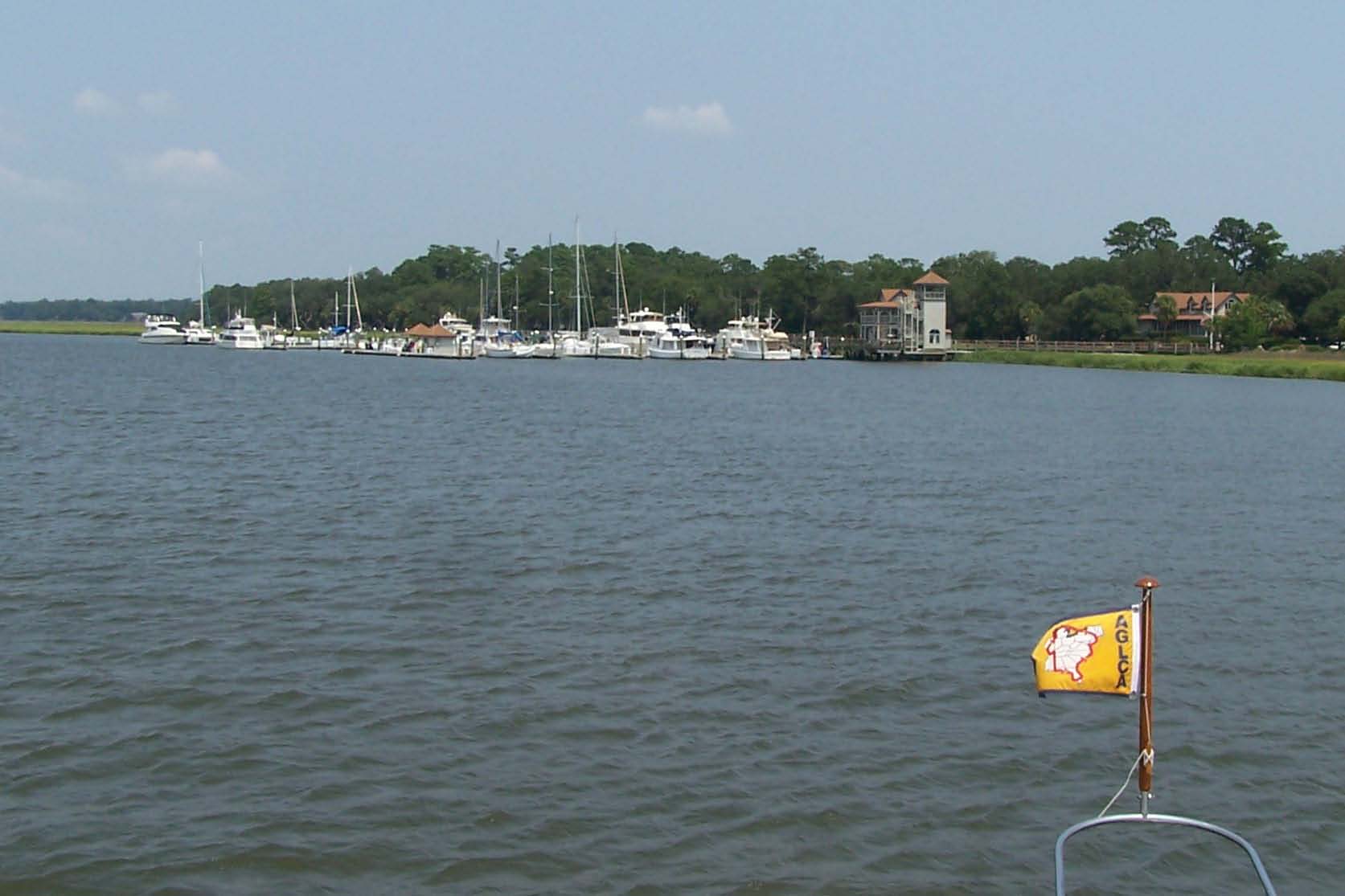
|
| Coming home to Delegal Creek Marina |
|
|
|
|
|
|
|
|
|
|
|
Pork Crock a la Coke
1 pork tenderloin
1 can Coke (we used caffeine-free Diet Coke)
1 bottle barbecue sauce
Dump all ingredients in a crock pot, and turn it on. Simmer all day.
Remove tenderloin from sauce, and carefully cut it into serving portions -- it will fall apart.
Serve with the simmering sauce on the side, Southern barbecue style.
|
|
|
|
