|
Wednesday, January 26, 2005
Wahoo Island, Georgia
|
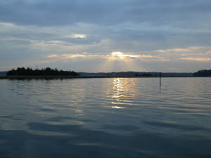
| Sunrise, Isle of Hope |
The 43 mile passage from Isle of Hope to Wahoo Island winds through lots of narrow rivers and channels lined
by marshes. We traveled miles without seeing solid land along many stretches of the ICW here.
The most interesting island we passed along the way was St. Catharine's Island. Our cruising guide
filled us in on the island's history. Before it was named St. Catharine's, it was the capitol of the Creek Indian
Confederacy. Then European countries took their turns at trying to control it, beginning with Spanish missionaries who
came up from Florida, and continuing with James Oglethorpe, who arrived to establish Georgia as an English colony in the mid-1700s.
Mary Musgrove, a half-Indian, half-white woman helped him negotiate with the Indians for land, and Oglethorpe rewarded her
with St. Catharine's and two other islands. When slavery began in Georgia in 1749, the government suddenly saw value
in the islands as potential plantations, and after a 10-year legal battle, they took two of her three islands, leaving
Mary with St. Cat's.
After the Civil War it was briefly an independent state for free slaves.
Now, in perhaps its most interesting incarnation, it is owned by the New York
Zoological Society and serves as a sanctuary for endangered species. Not native endangered species, but things like
gray zebras, sable antelopes and hartebeests. We didn't spy anything unusual as we passed by.
The day began overcast, but sun increased as the day wore on. By mid-afternoon when we anchored in
the Wahoo River, with Wahoo Island to one side of us, and marshes as far as we could see to the other side, it was warm enough
to enjoy a relaxing chips, guacamole and fresh-made salsa break on the flybridge.
A little after 7 pm, the moon rose huge and pumpkin orange in the east, and the stars were bright above
us in a clear sky.
Thursday, January 27-Saturday, January 29
St. Simon's Island, Georgia
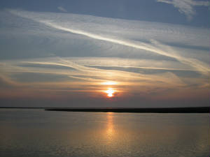
This is the sunrise that greeted us as we got up Thursday morning at Wahoo Island. As this glorious
sun was rising in the east, the moon was setting serenely silver in the clear blue sky west. The wind had shifted in
the night, so that the island hid its force from us. Until we turned on the weather radio, it seemed like another
grand day for cruising.
A nor'easter was blowing in, and the day got colder, the winds higher, and the waters choppier as we made
our way south to St. Simon's Island, adding layers of clothing as we went. We felt fortunate that the wind and waves were
following us from the north, because it would have been punishing to plow into them all day.
By the time we got to the dock of Golden Isle Marina, the winds were blowing at about 25 mph. Later,
the gusts would reach near 40 mph. We weren't cruising anywhere for a couple days.
|

